

Amigos International Co., Ltd has provided Land and Bathymetric surveying Services with professional surveyors and the latest equipment. Land and Bathymetric surveying work services have become essential in today's construction and infrastructure as building constructions, dam & irrigation canal constructions, building roads & bridges and Oil & Gas exploration sector, etc. Thus, let Amigos Surveying & Digital Mapping Services help get fast and precise geodetic and bathymetric survey data for your projects.
The Survey Team of Amigos has been taking care;
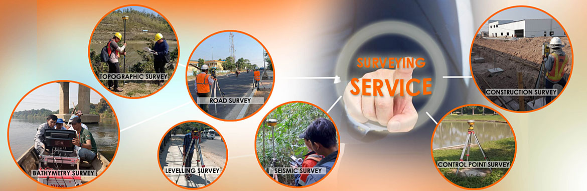
Construction Surveying services
Bathymetric Surveying services
Topographic Surveying services
Road Alignment and Construction Surveying services
Digital Mapping Services
Seismic Stakeout Surveying Services
Structure Alignment Monitoring Services
We use the latest Land Surveying Equipment, imported from Switzerland, and by professionals fast and precisely. The instruments are checked continuously for stability and right by the service engineers sent overseas and studied systematically.
Moreover, Amigos Survey Team has many lands and bathymetric survey projects with local and overseas companies all over Myanmar. We guarantee that your businesses can fully trust since we have been striving for improving quality by continuously learning about the ever-advancing technologies and ever-evolving instruments.
Since Amigos International Co., Ltd is a company working in partnership with international surveying instrument manufacturers, we could continuously achieve new technologies and training. Thus, in processing data and mapping, we can produce high-quality data and maps using the formerly commonly used Auto Desk Land Desktop Software and other map drawing software like Global Mapper, Google Earth, Micro Survey, X-Pad office MPS, etc. Let us, Amigos Surveying & Digital Mapping Services take the responsibility of precise data, trustworthy qualities for your businesses until you find satisfaction.
